
The tropical depression outside the Philippine Area of Responsibility (PAR) has intensified into a tropical storm, as of this afternoon, and is forecast to enter the country as a severe storm, to be locally named “Odette”, on Dec. 14.
The tropical cyclone advisory 4A of the Department of Science and Technology-Philippine Atmospheric, Geophysical and Astronomical Services Administration showed that, as of 5 p.m. Dec. 13, the center of the storm with international codename “Rai” was estimated based on all available data at 1,630 km east of Mindanao.
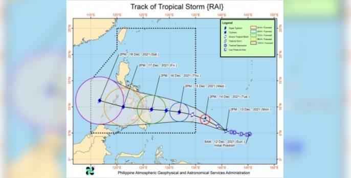
It has maximum sustained winds of 65 km/h near the center, gustiness of up to 80 km/h, and central pressure of 998 hPa.
The tropical storm is forecast to move west northwestward and will likely enter the PAR region tomorrow evening.
Current track and intensity forecast showed a high likelihood that Tropical Cyclone Wind Signals will be hoisted over Visayas, large portion of Mindanao, and several provinces in Southern Luzon due to the threat of strong to typhoon-force winds.
Localities situated in the eastern portions of Visayas and Mindanao may be placed under TCWS #1 as early as tomorrow afternoon or evening, the DOST-PAGASA said.
Ma. Aletha Nogra, officer-in-charge of the Regional Disaster Risk Reduction and Management Council 6, has issued Memorandum No. 114 on Dec. 12, urging all governors, mayors, chairpersons of the city or municipal DRRMO, and barangay officials in Western Visayas to undertake preparedness actions. | NND