
- CHERYL G. CRUZ
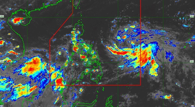
Monsoon rains are likely over Western Visayas and the western section of Southern Luzon in the coming days as Tropical Depression “Egay” maintains its strength and accelerates west northwestward over the Philippine sea.
The Philippine Atmospheric, Geophysical and Astronomical Services Administration said in its weather bulletin valid until 11 p.m. July 21 that “Egay” is forecast to intensify in the next 12 hours into a tropical storm, and may reach a super typhoon category by late Monday or early Tuesday.
“In areas not be directly affected by Egay, monsoon rains from the enhanced southwest monsoon are possible over the western section of Mimaropa and the Visayas on Sunday,” the PAGASA said, adding that under these conditions, flooding and rain-induced landslides are possible, especially in areas that are highly or very highly susceptible to these hazards as identified in hazard maps, and in localities that experienced considerable amounts of rainfall in the past several days.
Wind signals may be hoisted in some areas of Bicol Region and Eastern Visayas tonight or tomorrow morning. A landfall scenario over the eastern portion of mainland Cagayan and Batanes is not ruled out.
The center of TD Egay was estimated, based on all available data, at 835km east of southeastern Luzon. It is moving west northwestward at 20 km/h, with maximum sustained winds of 55 km/h near the center and gustiness of up to 70 km/h.
The public and disaster risk reduction and management offices concerned are advised to take all necessary measures to protect life and property. “Persons living in areas identified to be highly or very highly susceptible to hazards are advised to follow evacuation and other instructions from local officials,” the weather bureau added./CGC