The Sipalay City government, represented by Mayor Maria Gina Lizares, signed a memorandum of agreement with various reforestation project partners in the implementation of three programs in the city.
These include the Agroforestry Development Opportunities for Treasured Sipalaynon (ADOpTS), the Riverbank Protection Rehabilitation and Awareness Program (RiPRAP), and the Productive Landscape and Tree Growing towards Sustainable Sipalay (PLanTSS) programs.
These programs aim to introduce sustainable farming practices, rehabilitate riverbanks and riparian zones, increase forest cover, and rehabilitate watersheds and protected areas in the city.
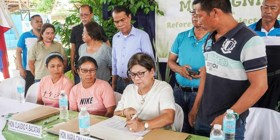
The MOA signing ceremony was held at the Barangay Gil Montilla covered court recently and witnessed by forester Wilfredo Canto, CENR officer; DENR-CENRO Kabankalan, Leo Chua – city ENRO, and Jamaica Mueda, LDRRM officer.
Also present were councilors Claudio Bacatan and Rome Vargas, city agriculturist Lani Yanong, Camindangan punong barangay Elir Borres, forester Reynante Aplicy, and ENRO staff, among others.
The team of supervising geologist Leilanie Suerte, senior geologist Shimpei Francisco, and geologist II Laila Grace Indillo, who conducted karst subsidence hazard assessment and mapping in different barangays of Sipalay in March, presented initial results April 22 at the New Government Center.
The assessment aims to locate, identify, and determine hazards caused by “karst terrains”, characterized by subterranean zones of carbonate or evaporite rocks that dissolved, forming caves, springs, and sinkholes, the city said in a press release.
It added that structures in the area with the presence of karst terrains are at risk for structural damage and the possibility of collapse, especially during adverse weather conditions.
The Mines and Geosciences Bureau (MGB) team, together with personnel from the local government, visited and identified several caves and sinkholes in the city, with the cooperation of the barangay councils. Specific areas in some barangays were identified to have these special terrains that may pose hazard to structures built above, and the area within it.
The team used a ground penetrating radar (GPR) to detect “anomalies” or changes in the subsurface of an area. They also visited and assessed government structures to ensure that these are built in areas without risks of collapse due to karst subsidence.
Due to the large amount of data generated by the month-long assessment and the GPR scans, the MGB team can only provide the maps and recommendations after all compilation and interpretation have been completed.
The assessment data and reports will provide an overview of the hazards in the different areas for proper assessment, planning, and action by the city government. ||