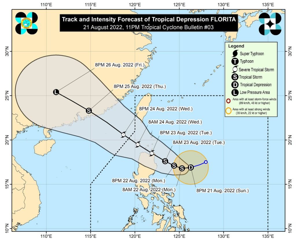
Tropical Depression Florita, the sixth tropical cyclone to develop in the Philippine area of responsibility (PAR) this year, has intensified while moving west southwestward, the Philippine Atmospheric, Geophysical and Astronomical Services Administration said Sunday, Aug. 21.
In its 5 p.m. weather bulletin, PAGASA said the center of the weather disturbance was last spotted 540 kilometers east of Tuguegarao City, Cagayan. It has maximum sustained winds of 55 kilometers per hour near the center and gustiness of up to 70 kph.
The state weather bureau said “Florita” is forecast to reach tropical storm category today, when classes for school year 2022-2023 start, and may reach peak intensity of 75 kph prior to making landfall on Tuesday morning or afternoon.

“Slight weakening is likely as it crosses the Northern Luzon, but it is forecast to remain within the tropical storm category,” the PAGASA said.
Light to moderate, with at times heavy rains, may prevail over Cagayan, Isabela, Batanes, and Aurora on Monday early morning through afternoon.
By Monday evening through Tuesday evening, heavy to intense, with at times torrential rains, will be felt over Batanes, Cagayan, Isabela, the Cordillera Administrative Region, and Ilocos Region. Light to moderate, with at times heavy rains, will be experienced over Central Luzon and the rest of Cagayan Valley.
Scattered to widespread flooding and rain-induced landslides are expected, especially in areas that are highly or very highly susceptible to these hazard, as identified in hazard maps and in localities with significant antecedent rainfall, the PNA report said.
“Florita” will bring moderate to rough seas over the eastern seaboards of Luzon. These conditions may be risky for those using small seagoing vessels, and mariners are advised to take precautionary measures when venturing out to sea and, if possible, avoid navigating in these conditions.
Meanwhile, PAGASA urged the public and disaster risk reduction and management offices concerned to take all necessary measures to protect life and property.
“Persons living in areas identified to be highly or very highly susceptible to these hazards are advised to follow evacuation and other instructions from local officials,” the state weather bureau said.
PAGASA also urged the public to monitor their respective Regional Services Division for heavy rainfall warnings, thunderstorm/rainfall advisories, and other severe weather information specific to their areas. ||


